Tool catalog
You can have the results of simple satellite data analysis with tools.
How to use the tools
There are two different usage methods. Depending on the tool, the environment and operation methods vary.
- API
-
Allows you to request analysis via API from the analysis environment provided by Tellus or your own system, and obtain the results.
- QGIS Plugin
-
Can be used with mouse operations on QGIS installed on “Tellus Satellite Data Master with QGIS”.
* “Tellus Satellite Data Master with QGIS” requires a separate contract. For details, click here.
-
TelluSAR
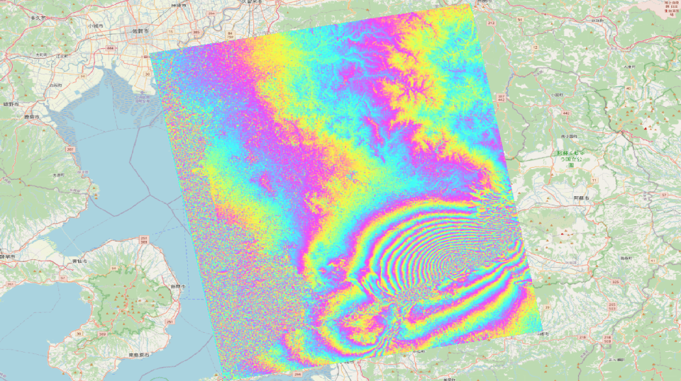
Measure ground subsidence and uplift with centimeter-level precision. TelluSAR is a tool designed for easily performing differential interferometric analysis with SAR data.
-
 Provider:Tellus Inc.
-
 Usage method:API, QGIS Plugin
-
 Target data:PALSAR, PALSAR-2, ASNARO-2
-
 Price:Free
-
 Usage environment:Available outside of Tellus
-
-
Tellus-Clairvoyant
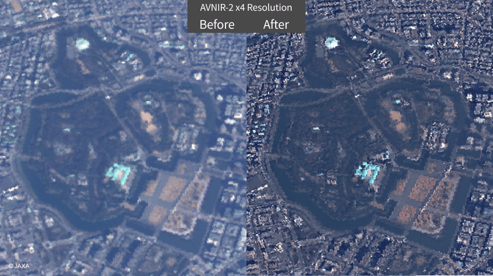
Tellus-Clairvoyant is a tool that uses deep learning technology to apply super-resolution processing to satellite images. The resolution can be enhanced up to 4 times.
-
Provider:Tellus Inc.
-
Usage method:API, QGIS Plugin
-
Target data:AVNIR-2, PALSAR-2
-
Price:Free
-
Usage environment:Available outside of Tellus
-
-
NEC Pansharpening
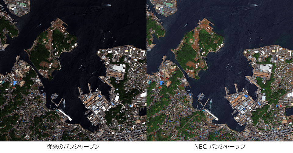
パンクロマチック画像(高解像モノクロ画像)とマルチスペクトル画像(低解像カラー画像)からパンシャープン画像(高解像度カラー画像)を作成します。
-
Provider:NEC Aerospace Systems, Ltd.
-
Usage method:API
-
Target data:(Not specified)
-
Price:Free
-
Usage environment:Available outside of Tellus
-


How to use
Executing the API requires an API token. Please refer to the instructions on how to issue an API token, and set it as a Bearer token. For individual endpoints, API references are provided on each detailed page.
Notes when using tool
- - Please review the copyright notice, terms of use, and other important notes on each detail page before using the service.
- - By using the API, you are considered to have agreed to the terms of use for the respective data and tools.
- - You need an agreement in advance for commercial use. Please inquire Tellus office.
Reference for terms
- * Target data
- The data that the tool can process
- * Usage environment
- Available outside of Tellus: You can use the tool in your own environment.
- Available only in Tellus: You can use the tool only in Tellus development/analysis environment.
-
Available data will be added accordingly.
Inquire Tellus office for data request or data availability. -
When you consider providing data, please inquire the Tellus office after checking followings.
Terrestrial data and tools are handled as free offerings.