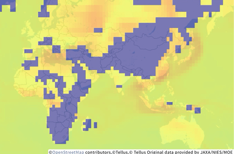
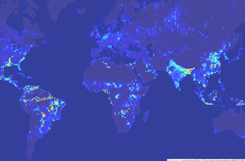
Data catalog
Various satellite and terrestrial data from both Japan and other countries is available in Tellus.
-
- Data types *1
-
- Ground Sampling Distance (GSD)
-
- Region *2
-
- Price
-
- Download *3
Satellite data (45)
-
ASNARO-1_L1B
Data from “ASNARO-1”, an optical satellite developed by Japan Space Systems and NEC, under contract with the Ministry of Economy, Trade and Industry.
-
 Data types:Optical data
-
 GSD:Equal to or more than 1m - less than 100m
-
 Region:Japan, Asia excluding Japan, Oceania, Europe, North America, South America, Africa
-
 Price:Free
-
 Download:Available only in Tellus
-
-
ASNARO-2 X-band SAR images Urban area dataset (STRIPMAP)
Synthetic Aperture Radar (SAR) data observed by “ASNARO-2”, developed by NEC, partly funded by the Ministry of Economy, Trade and Industry.
-
Data types:SAR
-
GSD:Equal to or more than 1m - less than 100m
-
Region:Japan
-
Price:Priced
-
Download:Available outside of Tellus
-
-
ASNARO-2_L1.1

Synthetic Aperture Radar (SAR) data observed by “ASNARO-2”, developed by NEC, partly funded by the Ministry of Economy, Trade and Industry.
-
Data types:SAR
-
GSD:Equal to or more than 1m - less than 100m
-
Region:Japan, Asia excluding Japan, Oceania
-
Price:Free
-
Download:Available only in Tellus
-
-
ASNARO-2_L1.5

Synthetic Aperture Radar (SAR) data observed by “ASNARO-2”, developed by NEC, partly funded by the Ministry of Economy, Trade and Industry.
-
Data types:SAR
-
GSD:Equal to or more than 1m - less than 100m
-
Region:Oceania
-
Price:Free
-
Download:Available only in Tellus
-
-
ASNARO-2_L2.1
Synthetic Aperture Radar (SAR) data observed by “ASNARO-2”, developed by NEC, partly funded by the Ministry of Economy, Trade and Industry.
-
Data types:SAR
-
GSD:Equal to or more than 1m - less than 100m
-
Region:Japan
-
Price:Free
-
Download:Available only in Tellus
-
-
ASTER GDEM ver.3
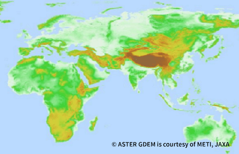
ASTER GDEM is elevation data with a horizontal resolution of approximately 30 m and a height accuracy of approximately 12 m (Japan domestic).
-
Data types:DEM
-
GSD:Equal to or more than 1m - less than 100m
-
Region:Japan, Asia excluding Japan, Oceania, Europe, North America, South America, Africa
-
Price:Free
-
Download:Available outside of Tellus
-
-
AVNIR-2_1B1
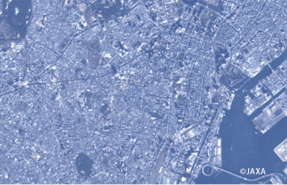
Data observed by optical sensor AVNIR-2 on board “Daichi (ALOS)” developed by JAXA.
-
Data types:Optical data
-
GSD:Equal to or more than 1m - less than 100m
-
Region:Japan, Asia excluding Japan, Oceania, Europe, North America, South America, Africa
-
Price:Free
-
Download:Available outside of Tellus
-
-
AW3D30
Data of the numerical elevation model, based on data from the PRISM sensor on board “Daichi (ALOS)” developed by JAXA.
-
Data types:DEM
-
GSD:Equal to or more than 1m - less than 100m
-
Region:Japan, Asia excluding Japan, Oceania, Europe, North America, South America, Africa
-
Price:Free
-
Download:Available outside of Tellus
-
-
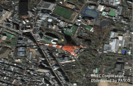
CE-SAT-IIB
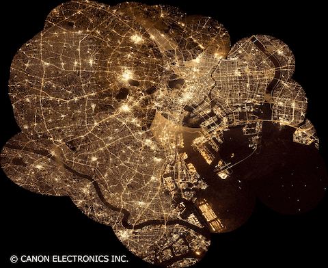
Nighttime data captured focusing on the 23 wards of Tokyo from January 2021 to May 2022 by “CE-SAT-IIB”, a microsatellite developed by Canon Electronics.
-
Data types:Optical data
-
GSD:Equal to or more than 1m - less than 100m
-
Region:Japan
-
Price:Free
-
Download:Available only in Tellus
-
-
Data with the optical multispectral band (0.8 m/3.2 m)
Re-sampled data with performance equivalent to the optical data with the optical multispectral band (0.8 m/3.2 m).
-
Data types:Optical data
-
GSD:Less than 1m
-
Region:Japan, Asia excluding Japan
-
Price:Free
-
Download:Available only in Tellus
-
-
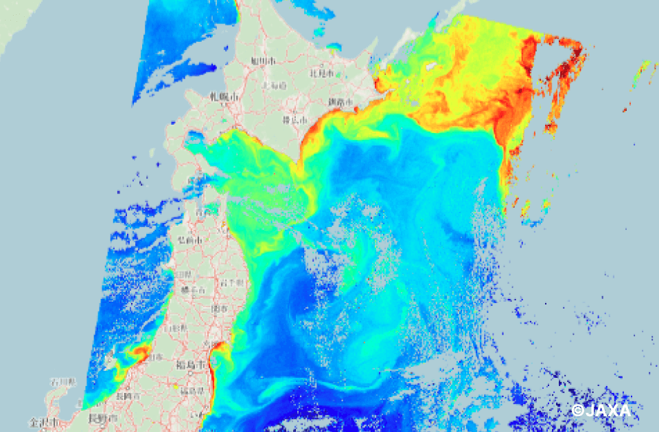
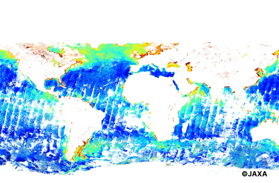
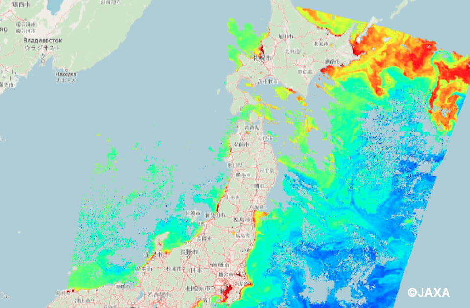
GCOM-C/CHLA_8days
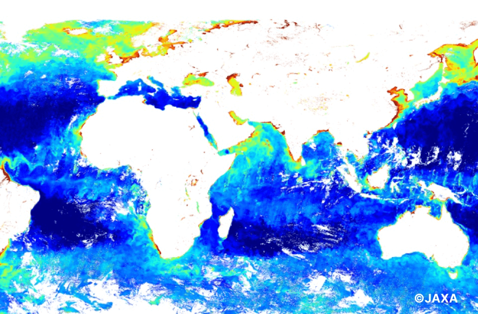
Chlorophyll-a concentration (physical quantity) is calculated from information observed by SGLI onboard “Shikisai (GCOM-C)” developed by JAXA, and statistically processed globally every 8 days.
-
Data types:Environmental
-
GSD:Equal to or more than 100m
-
Region:Japan, Asia excluding Japan, Oceania, Europe, North America, South America, Africa
-
Price:Free
-
Download:Available outside of Tellus
-
-
GCOM-C/CHLA_NRT
Data of Chlorophyll-a concentration (physical quantity), calculated from information observed by the SGLI sensor onboard “Shikisai (GCOM-C)” developed by JAXA.
-
Data types:Environmental
-
GSD:Equal to or more than 100m
-
Region:Japan, Asia excluding Japan, Oceania
-
Price:Free
-
Download:Available outside of Tellus
-
-
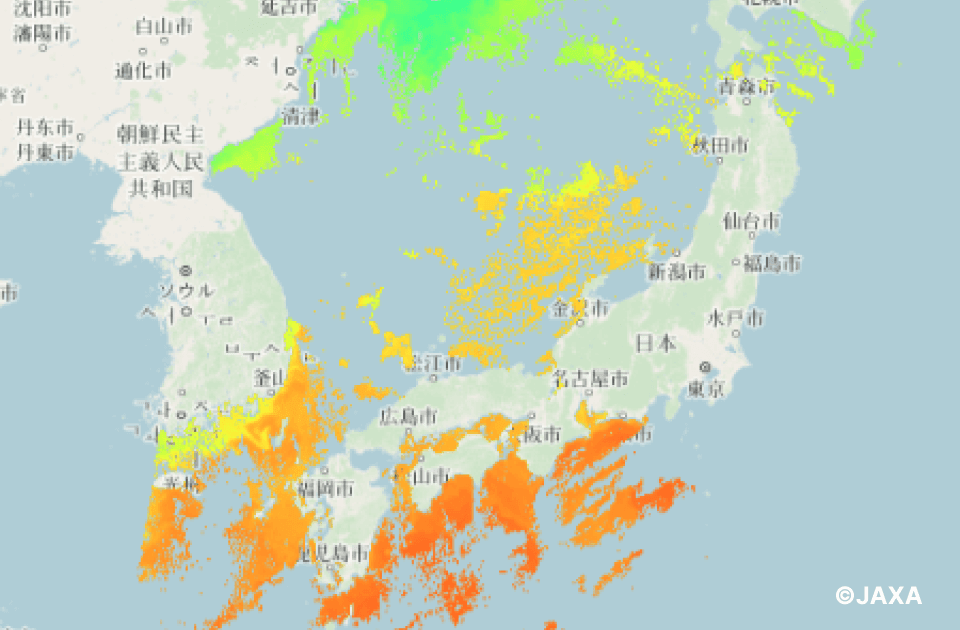
GCOM-C/SST_8days
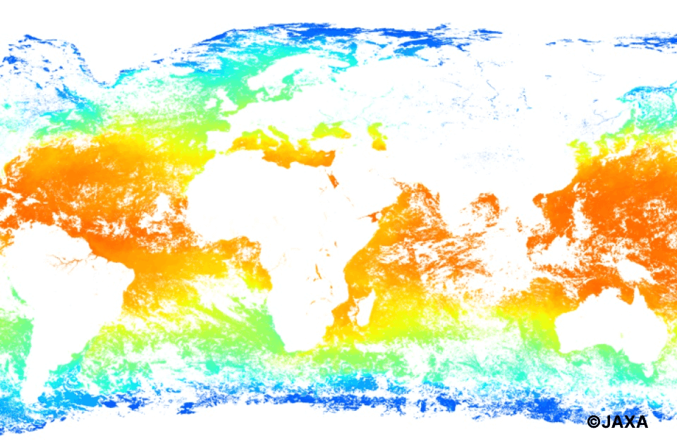
Sea surface temperature (physical quantity) is calculated from information observed by SGLI onboard “Shikisai (GCOM-C)” developed by JAXA, and statistically processed globally every 8 days.
-
Data types:Environmental
-
GSD:Equal to or more than 100m
-
Region:Japan, Asia excluding Japan, Oceania, Europe, North America, South America, Africa
-
Price:Free
-
Download:Available outside of Tellus
-
-
GCOM-C/SST_NRT
Data of the sea surface temperature (physical quantity), calculated from information observed by the SGLI sensor onboard “Shikisai (GCOM-C)” developed by JAXA.
-
Data types:Environmental
-
GSD:Equal to or more than 100m
-
Region:Japan, Asia excluding Japan, Oceania
-
Price:Free
-
Download:Available outside of Tellus
-
-
GCOM-C/TSM_8days
Suspended solids concentration (physical quantity) is calculated from information observed by SGLI onboard “Shikisai (GCOM-C)” developed by JAXA, and statistically processed globally every 8 days.
-
Data types:Environmental
-
GSD:Equal to or more than 100m
-
Region:Japan, Asia excluding Japan, Oceania, Europe, North America, South America, Africa
-
Price:Free
-
Download:Available outside of Tellus
-
-
GCOM-C/TSM_NRT
Data of suspended solid concentration (physical quantity) calculated from information observed by the SGLI sensor onboard the “Shikisai (GCOM-C)” developed by JAXA.
-
Data types:Environmental
-
GSD:Equal to or more than 100m
-
Region:Japan, Asia excluding Japan, Oceania
-
Price:Free
-
Download:Available outside of Tellus
-
-
GOSAT/L2/SWIR CO2 column amount(G1-01)
L2 CO2 column amount data retrieved from SWIR radiance spectral data observed by TANSO-FTS onboard GOSAT.
-
Data types:Environmental
-
GSD:Equal to or more than 100m
-
Region:Japan, Asia excluding Japan, Oceania, Europe, North America, South America, Africa
-
Price:Free
-
Download:Available outside of Tellus
-
-
GOSAT/L2/SWIR CH4 column amount(G1-02)
L2 CH4 column amount data retrieved from SWIR radiance spectral data observed by TANSO-FTS onboard GOSAT.
-
Data types:Environmental
-
GSD:Equal to or more than 100m
-
Region:Japan, Asia excluding Japan, Oceania, Europe, North America, South America, Africa
-
Price:Free
-
Download:Available outside of Tellus
-
-
GOSAT/L2/SWIR H2O column amount(G1-03)
L2 H2O column amount data retrieved from SWIR radiance spectral data observed by TANSO-FTS onboard GOSAT.
-
Data types:Environmental
-
GSD:Equal to or more than 100m
-
Region:Japan, Asia excluding Japan, Oceania, Europe, North America, South America, Africa
-
Price:Free
-
Download:Available outside of Tellus
-
-
GOSAT/L2/TIR CO2 vertical profile(Day side)(G1-04-1)
L2 vertical profile of CO2 concentration (Day side) data retrieved from TIR radiance spectral data observed by TANSO-FTS onboard GOSAT.
-
Data types:Environmental
-
GSD:Equal to or more than 100m
-
Region:Japan, Asia excluding Japan, Oceania, Europe, North America, South America, Africa
-
Price:Free
-
Download:Available outside of Tellus
-
-
GOSAT/L2/TIR CO2 vertical profile(Night side)(G1-04-2)
L2 vertical profile of CO2 concentration (Night side) data retrieved from TIR radiance spectral data observed by TANSO-FTS onboard GOSAT.
-
Data types:Environmental
-
GSD:Equal to or more than 100m
-
Region:Japan, Asia excluding Japan, Oceania, Europe, North America, South America, Africa
-
Price:Free
-
Download:Available outside of Tellus
-
-
GOSAT/L2/TIR CH4 vertical profile(Day side)(G1-05-1)
L2 vertical profile of CH4 concentration (Day side) data retrieved from TIR radiance spectral data observed by TANSO-FTS onboard GOSAT.
-
Data types:Environmental
-
GSD:Equal to or more than 100m
-
Region:Japan, Asia excluding Japan, Oceania, Europe, North America, South America, Africa
-
Price:Free
-
Download:Available outside of Tellus
-
-
GOSAT/L2/TIR CH4 vertical profile(Night side)(G1-05-2)
L2 vertical profile of CH4 concentration (Night side) data retrieved from TIR radiance spectral data observed by TANSO-FTS onboard GOSAT.
-
Data types:Environmental
-
GSD:Equal to or more than 100m
-
Region:Japan, Asia excluding Japan, Oceania, Europe, North America, South America, Africa
-
Price:Free
-
Download:Available outside of Tellus
-
-
GOSAT/L3/SWIR global CO2 distribution(G1-06)
L3 global distribution data of CO2 concentration, estimated from L2 CO2 column amount data retrieved from the data observed by TANSO-FTS onboard GOSAT.
-
Data types:Environmental
-
GSD:Equal to or more than 100m
-
Region:Japan, Asia excluding Japan, Oceania, Europe, North America, South America, Africa
-
Price:Free
-
Download:Available outside of Tellus
-
-
GOSAT/L3/SWIR global CH4 distribution(G1-07)
L3 global distribution data of CH4 concentration, estimated from L2 CH4 column amount data retrieved from the data observed by TANSO-FTS onboard GOSAT.
-
Data types:Environmental
-
GSD:Equal to or more than 100m
-
Region:Japan, Asia excluding Japan, Oceania, Europe, North America, South America, Africa
-
Price:Free
-
Download:Available outside of Tellus
-
-
GOSAT/L4A/global CO2 flux(G1-08)
L4A global distribution data of CO2 flux, estimated from L2 CO2 column amount data retrieved from the data observed by TANSO-FTS onboard GOSAT.
-
Data types:Environmental
-
GSD:Equal to or more than 100m
-
Region:Japan, Asia excluding Japan, Oceania, Europe, North America, South America, Africa
-
Price:Free
-
Download:Available outside of Tellus
-
-
GOSAT/L4A/global CH4 flux(G1-09)
L4A global distribution data of CH4 flux, estimated from L2 CH4 column amount data retrieved from the data observed by TANSO-FTS onboard GOSAT.
-
Data types:Environmental
-
GSD:Equal to or more than 100m
-
Region:Japan, Asia excluding Japan, Oceania, Europe, North America, South America, Africa
-
Price:Free
-
Download:Available outside of Tellus
-
-
GOSAT/L4B/global CO2 distribution(G1-10)
L4B global three-dimensional distribution data of CO2 concentration, estimated from L4A CO2 flux data estimated from the information observed by TANSO-FTS onboard GOSAT.
-
Data types:Environmental
-
GSD:Equal to or more than 100m
-
Region:Japan, Asia excluding Japan, Oceania, Europe, North America, South America, Africa
-
Price:Free
-
Download:Available outside of Tellus
-
-
GOSAT/L4B/global CH4 distribution(G1-11)
L4B global three-dimensional distribution data of CH4 concentration, estimated from L4A CH4 flux data estimated from the information observed by TANSO-FTS onboard GOSAT.
-
Data types:Environmental
-
GSD:Equal to or more than 100m
-
Region:Japan, Asia excluding Japan, Oceania, Europe, North America, South America, Africa
-
Price:Free
-
Download:Available outside of Tellus
-
-
GOSAT-2/L2/SWIR CO2 column-averaged dry-air mole fraction(G2-01)
L2 CO2 column-averaged dry-air mole fraction data retrieved from SWIR radiance spectral data observed by TANSO-FTS-2 onboard GOSAT-2.
-
Data types:Environmental
-
GSD:Equal to or more than 100m
-
Region:Japan, Asia excluding Japan, Oceania, Europe, North America, South America, Africa
-
Price:Free
-
Download:Available outside of Tellus
-
-
GOSAT-2/L2/SWIR CH4 column-averaged dry-air mole fraction(G2-02)
L2 CH4 column-averaged dry-air mole fraction data retrieved from SWIR radiance spectral data observed by TANSO-FTS-2 onboard GOSAT-2.
-
Data types:Environmental
-
GSD:Equal to or more than 100m
-
Region:Japan, Asia excluding Japan, Oceania, Europe, North America, South America, Africa
-
Price:Free
-
Download:Available outside of Tellus
-
-
GOSAT-2/L2/SWIR CO column-averaged dry-air mole fraction(G2-03)
L2 CO column-averaged dry-air mole fraction data retrieved from SWIR radiance spectral data observed by TANSO-FTS-2 onboard GOSAT-2.
-
Data types:Environmental
-
GSD:Equal to or more than 100m
-
Region:Japan, Asia excluding Japan, Oceania, Europe, North America, South America, Africa
-
Price:Free
-
Download:Available outside of Tellus
-
-
GOSAT-2/L2/SWIR H2O column-averaged dry-air mole fraction(G2-04)
L2 H2O column-averaged dry-air mole fraction data retrieved from SWIR radiance spectral data observed by TANSO-FTS-2 onboard GOSAT-2.
-
Data types:Environmental
-
GSD:Equal to or more than 100m
-
Region:Japan, Asia excluding Japan, Oceania, Europe, North America, South America, Africa
-
Price:Free
-
Download:Available outside of Tellus
-
-
GOSAT-2/L4A/global CO2 flux(G2-09)
L4A global distribution data of CO2 flux, estimated from L2 CO2 column-averaged dry-air mole fraction data retrieved from the data observed by TANSO-FTS-2 onboard GOSAT-2.
-
Data types:Environmental
-
GSD:Equal to or more than 100m
-
Region:Japan, Asia excluding Japan, Oceania, Europe, North America, South America, Africa
-
Price:Free
-
Download:Available outside of Tellus
-
-
GOSAT-2/L4B/global CO2 distribution(G2-10)
L4B global three-dimensional distribution data of CO2 concentration, estimated from L4A CO2 flux data estimated from the information observed by TANSO-FTS-2 onboard GOSAT-2.
-
Data types:Environmental
-
GSD:Equal to or more than 100m
-
Region:Japan, Asia excluding Japan, Oceania, Europe, North America, South America, Africa
-
Price:Free
-
Download:Available outside of Tellus
-
-
GOSAT-2/L4A/global CH4 flux(G2-11)
L4A global distribution data of CH4 flux, estimated from L2 CH4 column-averaged dry-air mole fraction data retrieved from the data observed by TANSO-FTS-2 onboard GOSAT-2.
-
Data types:Environmental
-
GSD:Equal to or more than 100m
-
Region:Japan, Asia excluding Japan, Oceania, Europe, North America, South America, Africa
-
Price:Free
-
Download:Available outside of Tellus
-
-
GRUS_L3A
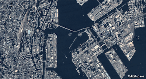
GRUS, developed by Axelspace, is a next-generation remote-sensing microsatellites’ constellation.
-
Data types:Optical data
-
GSD:Equal to or more than 1m - less than 100m
-
Region:Japan
-
Price:Free
-
Download:Available only in Tellus
-
-
HISUI
Data from “HISUI”, a spaceborne hyperspectral sensor developed by the Ministry of Economy, Trade and Industry, which is on board the Japanese Experiment Module “Kibo” on the International Space Station.
-
Data types:Optical data
-
GSD:Equal to or more than 1m - less than 100m
-
Region:Japan, Asia excluding Japan, Oceania, Europe, North America, South America, Africa
-
Price:Free
-
Download:Available outside of Tellus
-
-
Maxar Technologies' satellites
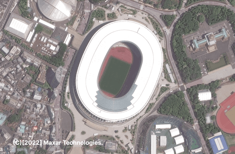
Maxar Technologies Inc. has very-high-resolution optical satellites. Resolutions of 30cm, 40cm, and 50cm are available. You can find fresh imagery captured from around the world by these satellites. We will accept your tasking requests for new image.
-
Data types:Optical data
-
GSD:Less than 1m
-
Region:Japan, Asia excluding Japan, Oceania, Europe, North America, South America, Africa
-
Price:Priced
-
Download:Available outside of Tellus
-
-
PALSAR_L1.1
Data observed by PALSAR, an L-band Synthetic Aperture Radar (SAR) on board “Daichi (ALOS)” developed by JAXA.
-
Data types:SAR
-
GSD:Equal to or more than 1m - less than 100m
-
Region:Japan, Asia excluding Japan, Oceania, Europe, North America, South America, Africa
-
Price:Free
-
Download:Available outside of Tellus
-
-
PALSAR_L2.2

Data observed by PALSAR, an L-band Synthetic Aperture Radar (SAR) on board “Daichi (ALOS)” developed by JAXA.
-
Data types:SAR
-
GSD:Equal to or more than 1m - less than 100m
-
Region:Japan, Asia excluding Japan, Oceania, Europe, North America, South America, Africa
-
Price:Free
-
Download:Available outside of Tellus
-
-
PALSAR-2_L1.1
Data observed by PALSAR-2, an L-band Synthetic Aperture Radar (SAR) on board “Daichi-2 (ALOS-2)” developed by JAXA.
-
Data types:SAR
-
GSD:Equal to or more than 1m - less than 100m
-
Region:Japan, Asia excluding Japan, Europe, North America, South America, Africa
-
Price:Free
-
Download:Available only in Tellus
-
-
PALSAR-2_L2.1

Data observed by PALSAR-2, an L-band Synthetic Aperture Radar (SAR) on board “Daichi-2 (ALOS-2)” developed by JAXA.
-
Data types:SAR
-
GSD:Equal to or more than 1m - less than 100m
-
Region:Japan, Asia excluding Japan, Oceania, Europe, North America, South America, Africa
-
Price:Free
-
Download:Available only in Tellus
-
-
PALSAR-2_L2.2
Data observed by PALSAR-2, an L-band Synthetic Aperture Radar (SAR) on board “Daichi-2 (ALOS-2)” developed by JAXA.
-
Data types:SAR
-
GSD:Equal to or more than 1m - less than 100m
-
Region:Japan, Asia excluding Japan, Oceania
-
Price:Free
-
Download:Available outside of Tellus
-
-
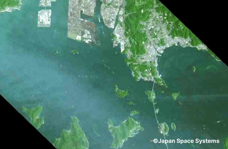
SLATS_1B
Data observed by optical sensor (panchromatic), SHIROP onboard “Tsubame (SLATS)” developed by JAXA.
-
Data types:Optical data
-
GSD:Less than 1m
-
Region:Japan, Asia excluding Japan, Oceania, Europe, North America, South America, Africa
-
Price:Free
-
Download:Available only in Tellus
-


How to use
Please learn “Data guide” to use data in each use setting.
When using API, learn “Traveler API reference”.
Notes when using data
- - When using data, please make sure to check copyrights in the data details page.
- - You can use your derivative works generated in Tellus as you need. Refer here for more information.
- - Some data prohibits copying the original data to use outside of Tellus including just a part of, or formatted data that can be restored back to the original.
- - When using data in your own environment outside of Tellus, please notice that some of the data prohibit the usage or downloading. Please make sure to read the data details page.
- - You need an agreement in advance for commercial use. Please inquire Tellus office.
Reference for terms
- *1 Data type
- The Basics of satellite data - What it tells us, types, observation interval, resolution and use cases - Sorabatake
- *2 Region
- Observation area for data available in Tellus
- *3 Download
- Available outside of Tellus: You can download data to your own environment to use.
- Available only in Tellus: You can download data to use only in Tellus development/analysis environment.
-
Available data will be added accordingly.
Inquire Tellus office for data request or data availability. -
When you consider providing data, please inquire the Tellus office after checking followings.
Terrestrial data and tools are handled as free offerings.