New items ”AW3D30" Ver.3.2 were added to Tellus Traveler!!
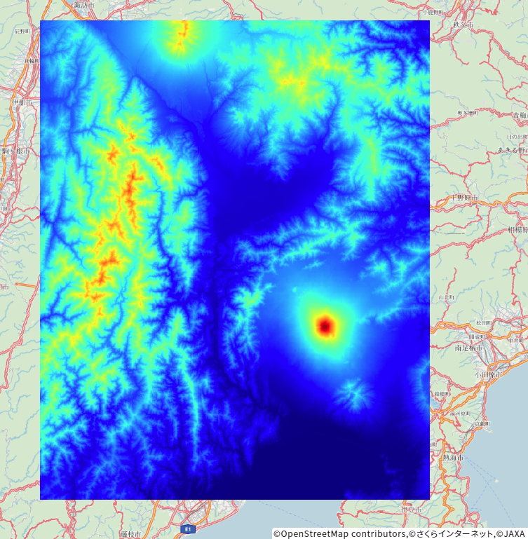
New dataElevation data "AW3D30 (Ver. 2.1)" has been available on Tellus OS and API, and now "AW3D30" Ver. 3.2 is available on Tellus Traveler. The data is also available for download.
AW3D30 is a digital elevation model with an equivalent of 30m horizontal resolution and a target of 5m elevation generated from data of the Panchromatic Remote-sensing Instrument for Stereo Mapping (PRISM) on the Advanced Land Observing Satellite (ALOS) developed by JAXA.
■ Resolution: 1 arcsecond in latitude and longitude (30-meter mesh)
■ Target height accuracy:5 meters (standard deviation)
■ Product information
https://www.eorc.jaxa.jp/ALOS/en/dataset/aw3d_e.htm
■ Product format description (Original data)※
https://www.eorc.jaxa.jp/ALOS/jp/dataset/aw3d30/data/aw3d30v3.2_product_j_e1.2.pdf
※There are some difference in data format original and published on Tellus.