The different extraction tool "Tellus-DEUCE" has been released.
New dataThank you for your continued support of "Tellus".
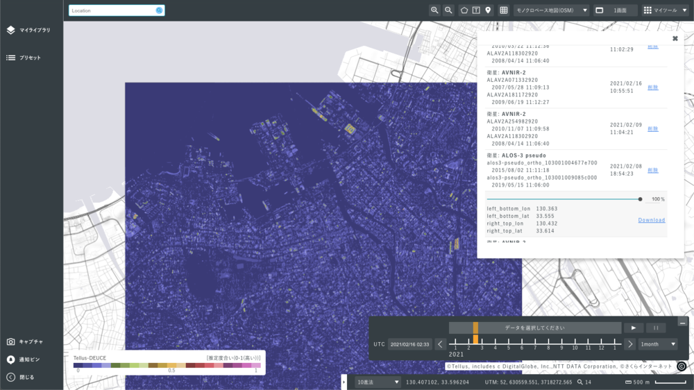
We started to provide a free prototype of the "Difference Extraction Tool/Tellus-DEtector on Urban ChangE" (hereinafter referred to as "Tellus-DEUCE"), which automatically extracts changes in cities and buildings from two satellite images.
The "Tellus-DEUCE" is a tool that can automatically extract changes in satellite images between two time periods using deep learning technology. It is capable of analyzing data equivalent to AVNIR-2 and ALOS-3 satellite images.This enables us to understand the construction status of buildings in remote areas such as overseas and the impact of disasters.
Details of "Difference Extraction Tool/Tellus-DEUCE
・Provider Name: "Tellus" Official
・Category: Algorithms and Add-ins
・Potential Applications: The field of "Overseas Support", "Urban Development","Disaster Prevention & Insurance" and "Finance" ・Price: Free of charge ・Details: https://www.tellusxdp.com/market/en-us
Usage image of the "Tellus-DEUCE" (the difference extraction tool)